East River Transformation
Written for the now-defunct online publication The World Edition.
New York City is in the midst of its largest building boom since the days of Robert Moses and his modernization of the five boroughs. Where the “master builder” used federal funds to build parkways and highways, parks, pools, playgrounds, zoos, bridges, and public housing, the latest spurt of construction is marked by private developers and large-scale, money-making projects in response to the ever-skyward housing market, the rezoning of many parts of the city, and a projected addition of one million more residents by 2030, as determined by Mayor Michael Bloomberg and his PLaNYC.
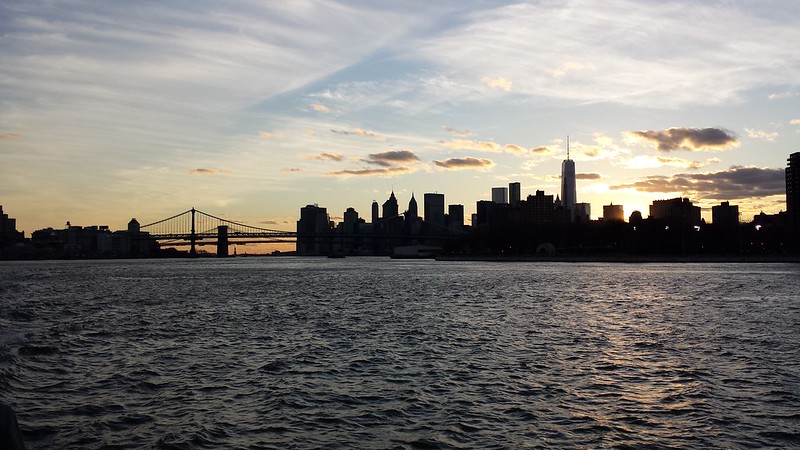
While Manhattan is still seen as the most desirable place to live in New York City, a number of new housing projects are situated along the East River in Brooklyn and Queens, taking advantage of waterfront industrial sites rezoned for residential uses and the stupendous views of Midtown Manhattan to the west. Historically, New York has turned its back on the water and the industry it harbored, but as the city continues to be the place for service-oriented industry and tourism it’s realizing the value of the waterfront for public space and private developments. By conceptually envisioning the East River as an urban space, rather than as a leftover or forgotten space, the whole spine of the city could feasibly shift over time from the middle of Manhattan to this undervalued waterway.
The massive Queens West Development in Long Island City is just one project pushing this reconsideration of the waterfront, its six residential towers sitting directly across from the United Nations in Midtown Manhattan. Directly north of Queens West are the two towers of the River East Condos and further north still is Silvercup West, a mixed-use development next to the Queensborough Bridge that is comprised of two residential towers, an office tower and facilities for Silvercup Studios. These three developments will eventually create a dramatically different eastern skyline, one previously monopolized by the stepped profile of Roosevelt Island.
Developments on Brooklyn’s waterfront to the south include Northside Piers’three condominium towers and townhouses, Palmer’s Dock’s affordable housing, The Edge’s 1,000 residential units in a mix of mid-rise buildings and high-rises, the condos at North 8 development, the Schaefer Landing condos, and the redevelopment of the former Domino Sugar Refinery. These six projects are the result of the Greenpoint-Williamsburg rezoning approved by the City in 2005, which aims to reclaim two miles of East River waterfront for public open space and housing. These developments, and those further south in Brooklyn Heights and Red Hook – including the Brooklyn Cruise Ship Terminal – are potentially strengthened by the ongoing East River Waterfront Esplanade and Piers Project across the river in Manhattan.
With the improvement of both the east and west waterfronts on this stretch of the East River straddling the Brooklyn and Williamsburg Bridges, the potential for the river to become an urban space seems that much more realistic. Combined with small-scale developments, reliable transportation alternatives, such as ferries and water taxis, and quality public open spaces, the waterfront along the East River could become a desirable place not only for views from million-dollar condos, but for activities of all sorts for all people.
New York City is in the midst of its largest building boom since the days of Robert Moses and his modernization of the five boroughs. Where the “master builder” used federal funds to build parkways and highways, parks, pools, playgrounds, zoos, bridges, and public housing, the latest spurt of construction is marked by private developers and large-scale, money-making projects in response to the ever-skyward housing market, the rezoning of many parts of the city, and a projected addition of one million more residents by 2030, as determined by Mayor Michael Bloomberg and his PLaNYC.
While Manhattan is still seen as the most desirable place to live in New York City, a number of new housing projects are situated along the East River in Brooklyn and Queens, taking advantage of waterfront industrial sites rezoned for residential uses and the stupendous views of Midtown Manhattan to the west. Historically, New York has turned its back on the water and the industry it harbored, but as the city continues to be the place for service-oriented industry and tourism it’s realizing the value of the waterfront for public space and private developments. By conceptually envisioning the East River as an urban space, rather than as a leftover or forgotten space, the whole spine of the city could feasibly shift over time from the middle of Manhattan to this undervalued waterway.
The massive Queens West Development in Long Island City is just one project pushing this reconsideration of the waterfront, its six residential towers sitting directly across from the United Nations in Midtown Manhattan. Directly north of Queens West are the two towers of the River East Condos and further north still is Silvercup West, a mixed-use development next to the Queensborough Bridge that is comprised of two residential towers, an office tower and facilities for Silvercup Studios. These three developments will eventually create a dramatically different eastern skyline, one previously monopolized by the stepped profile of Roosevelt Island.
Developments on Brooklyn’s waterfront to the south include Northside Piers’three condominium towers and townhouses, Palmer’s Dock’s affordable housing, The Edge’s 1,000 residential units in a mix of mid-rise buildings and high-rises, the condos at North 8 development, the Schaefer Landing condos, and the redevelopment of the former Domino Sugar Refinery. These six projects are the result of the Greenpoint-Williamsburg rezoning approved by the City in 2005, which aims to reclaim two miles of East River waterfront for public open space and housing. These developments, and those further south in Brooklyn Heights and Red Hook – including the Brooklyn Cruise Ship Terminal – are potentially strengthened by the ongoing East River Waterfront Esplanade and Piers Project across the river in Manhattan.
With the improvement of both the east and west waterfronts on this stretch of the East River straddling the Brooklyn and Williamsburg Bridges, the potential for the river to become an urban space seems that much more realistic. Combined with small-scale developments, reliable transportation alternatives, such as ferries and water taxis, and quality public open spaces, the waterfront along the East River could become a desirable place not only for views from million-dollar condos, but for activities of all sorts for all people.
Comments
Post a Comment
Comments are moderated for spam.